

Surface water monitoring is a crucial tool for environmental management in Western Australia’s mining industry. On WA mine sites, surface water includes rivers, creeks, ephemeral streams, pit lakes, tailings return water, evaporation ponds, reservoirs and even just stormwater from the site – all of which can be affected by the day-to-day operations of a mine like dewatering, land clearing and treatment plant discharge. These water bodies are vulnerable to changes in their condition due to mining activities, and monitoring is essential to ensuring their sustainable management and protecting the health of people who use the water and the natural environment downstream.
For mining companies operating in the Pilbara, Goldfields, Mid West and South West of WA, surface water monitoring is a key part of environmental compliance, licence conditions and corporate ESG reporting. Water scarcity in the Perth region relies heavily on monitoring to ensure there’s enough water available, and the impacts of urban development on river systems and wetlands in Perth necessitate regular monitoring – the same goes for remote mine sites where water resources are critical to supporting pastoralists, ecosystems and cultural values. Environmental Site Services provides surface water monitoring services across Western Australia – our team can deliver consultancy, field sampling, instrumentation and data collection to help clients meet their regulatory obligations.
Some of the key terms you’ll come across in this article include water quality monitoring (looking at chemical and physical parameters), water quantity (looking at flow and volume), water levels, surface water data, continuous monitoring, dissolved oxygen, turbidity and pH levels. This article covers:
- Regulatory context in WA
- Designing a monitoring program
- What parameters are most important to monitor at a mine site
- From manual sampling to using telemetry
- Using data to meet compliance and manage risk
- Integrating monitoring with broader environmental management
The Regulatory Framework for Surface Water Monitoring in WA Mining
Monitoring programs need to be aligned to WA state legislation and specific site approval conditions. Effective monitoring is based on evidence to protect water resources, and the data from monitoring helps to inform evidence-based decision-making in environmental projects. Monitoring ensures that mining companies are complying with environmental laws around water quality.
Some key legislation in WA includes:
- Environmental Protection Act 1986 (WA) – Part IV (EPA assessments, Ministerial Statements) and Part V (licensing of prescribed premises), which set discharge limits and monitoring requirements\
- Rights in Water and Irrigation Act 1914 – governs abstraction or diversion of surface water where dewatering occurs\
- Mining Act 1978 – conditions applied through mining proposals and Mine Closure Plans\
- Contaminated Sites Act 2003 – addresses legacy contamination in surface water bodies and sediments
The Department of Water and Environmental Regulation (DWER) issues Part V licences, publishes Water Quality Protection Notes, and enforces conditions. The Department of Mines, Industry Regulation and Safety (DMIRS) provides guidance on environmental management and reporting. For some context – the Victorian Water Act 1989 requires coordinated water monitoring, with over 900 locations monitored for water quantity and quality in Victoria – WA’s similar framework demands comprehensive coverage. Any risk assessment frameworks must guide contamination monitoring efforts in Perth and across regional sites. Monitoring is required at every stage of land development under the Better Urban Water Management Framework.
Approvals will typically require baseline surface water data, ongoing water quality and water level monitoring, event-based sampling after significant rainfall events, and reporting through Annual Environmental Reports and Compliance Assessment Reports. Programs must reference ANZG 2018 guidelines and site-specific trigger values.
Designing a Compliant Surface Water Monitoring Program for Mine Sites
A robust program design is at the heart of regulatory acceptance. Monitoring objectives typically include showing compliance with licence limits, assessing the impacts of dewatering discharge on downstream creeks, and tracking sediment and metal loads from haul roads, waste rock landforms, and tailings storage facilities.
Monitoring locations should include upstream background reference sites, downstream impact sites along drainage lines, points of discharge like mine dewatering outlets or stormwater release points, and potential sensitive receptors like stock watering points, conservation reserves, estuaries and cultural heritage areas across the broader watershed.
Programs must capture both water quantity and water quality. Streamflow estimates are derived from water level data at gauging sites, so installing staff gauges or automatic loggers is essential. Streamflow can also be estimated from recorded water level data using rating curves at calibrated stations. Continuous monitoring of water levels is key for identifying flood and drought potential – really important for managing risk during intense Pilbara storms.
Temporal design should include routine monitoring (monthly or quarterly), continuous monitoring with loggers at key locations, and event-based sampling after significant rainfall (typically greater than 10–20 mm in 24 hours). Monitoring quantifies water availability for environmental flows even in periods of reducing rainfall. Environmental Site Services can offer scoping studies and desktop reviews to deliver tailored, regulator-ready monitoring programs for WA mining operations. Best practices in urban water management focus on tracking urban runoff and nutrient loads, and similar principles inform mine site stormwater design.
Key Surface Water Quality and Quantity Parameters on WA Mine Sites
Some of the key water quality and quantity parameters to monitor on WA mine sites include:
- Water quality monitoring (looking at chemical and physical parameters)
- Water quantity (looking at flow and volume)
- Water levels
- Surface water data
- Continuous monitoring
- Dissolved oxygen
- Turbidity
- pH levelsParameter selection is key and should align with the site risks, including the type of ore being mined, the processing method used, reagent use, and the regional geology – and of course regulatory expectations too. Surface water monitoring should include measuring water temperature and conductivity as standard , because that’s just good practice.
Core parameters are:
- pH – because pH levels have a huge impact on chemical reactions in water bodies and metal solubility, making this a must for acid mine drainage assessment
- Electrical conductivity and salinity – conductivity tells you the concentration of dissolved ions in the water, and it’s a good indicator of pollution levels. For example, back in 1985 they started collecting continuous salinity data along 400km of the River Murray, which is pretty handy for comparison.
- Temperature – water temperature has a big impact on aquatic life, influencing dissolved oxygen and biological processes
- Turbidity and TSS – turbidity measures water clarity and sediment levels from erosion, unsealed roads, and land clearing – that kind of thing
- Dissolved oxygen – dissolved oxygen levels are crucial for aquatic ecosystems, especially in ephemeral pools downstream of discharge points
- Major ions – like sulfate, chloride, sodium, calcium, and magnesium, all relevant to salinity and scaling
WA mining tends to be associated with a range of contaminants, including dissolved metals (arsenic, lead, nickel, copper, zinc, chromium, aluminium), and nutrients from explosives residues and sewage, plus hydrocarbons from fuel storage and workshops. Surface water monitoring also looks at sediment quality to see if contaminants are binding to particulates and therefore affecting water quality at sites.
Monitoring can identify environmental hazards like harmful algal blooms and fish deaths – and it’s not just about the environment, either: algae blooms can have a real impact on local economies, especially tourism and recreation in nearby wetlands. And when it comes to water temperature, the key thing is that continuous monitoring allows you to see ecosystem stress in real-time.
Water quantity metrics – like water levels at gauging stations, flow rates, and total discharge volumes from mine dewatering – are also important for calculating contaminant loads. Environmental Site Services can help define parameter suites that fit with DWER guidance and site-specific risk profiles.
Monitoring Methods: From Manual Sampling to Continuous Telemetry
Manual spot sampling and continuous monitoring are both useful in their own ways on WA mine sites.
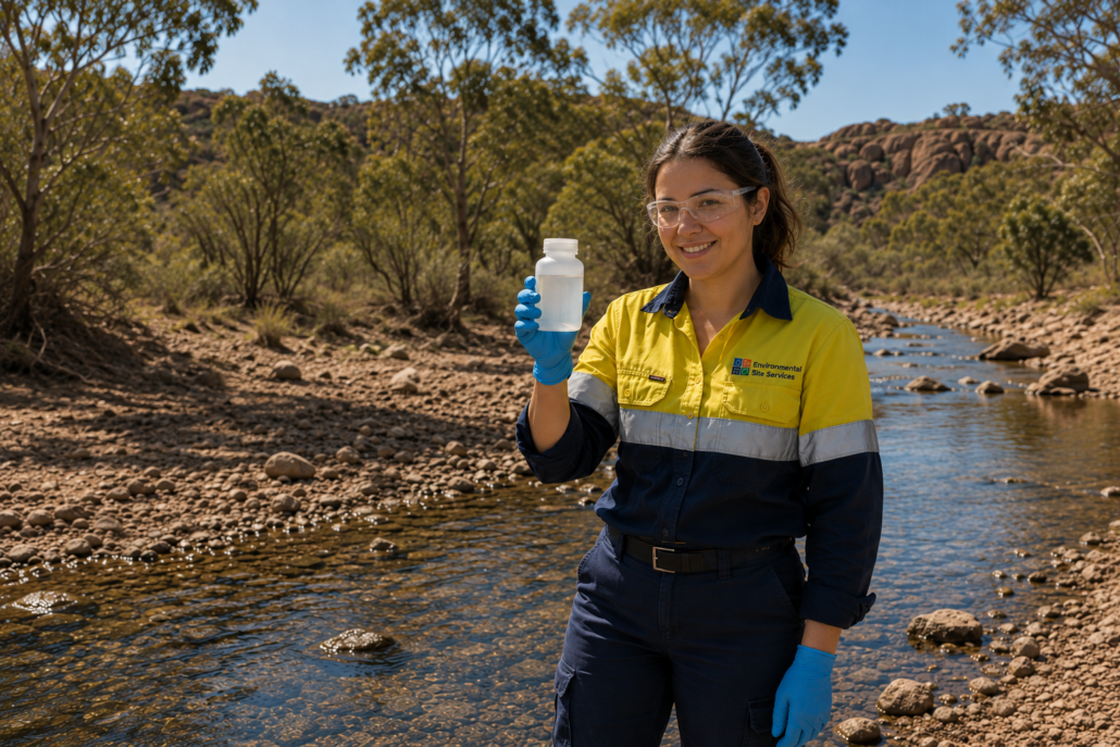
Manual (grab) sampling involves a field crew going out and taking samples at designated sites, following standard procedures (AS/NZS 5667 series). They also do some in-situ field measurements – pH, EC, temperature, dissolved oxygen, and turbidity, all measured up with calibrated meters. Then the samples get preserved and handed over to NATA-accredited labs. Automated sampling can spot pollutants too, especially when you’ve got event-based triggers set up in your water monitoring program.
Continuous monitoring uses automated data loggers that keep a continuous log of water levels for accurate monitoring – and multiparameter instruments that measure critical water quality parameters all at once. Telemetry systems let you get real-time data in for compliance monitoring, which can be via cell, satellite, or radio links. Having real-time data is vital for seeing how water quality responds to transient events. We’re now using IoT sensors to measure critical water quality metrics in real-time for all sorts of water science projects around the country. And of course telemetry lets water monitoring teams get real-time data access even at remote locations.
Event-based and mobile monitoring is just a fancy way of saying we’ve got mobile water testing stations that can sit out unattended for weeks at a time during commissioning, trial discharges, or big rainfall events. And then there’s geophysical methods like Electrical Resistivity Tomography to help map subsurface water content near seeps and tailings facilities.
QA/QC practices include scheduling equipment calibration, field duplicates and blanks, and thorough data validation. Environmental Site Services handles the full monitoring cycle: network design, logger and staff gauge installation, routine site visits, sampling, maintenance, data download, and calibration – all delivered with the aim of getting you defensible reporting.
Using Surface Water Data to Demonstrate Compliance and Manage Risk
Surface water data is not just a bunch of numbers to be collected – it’s essential evidence for demonstrating compliance and guiding on-ground decisions. Monitoring lets you spot early pollutants and manage contamination before it gets out of hand.
We evaluate data against licence limits set under the Environmental Protection Act 1986, site-specific trigger values endorsed by DWER, and ANZG 2018 guideline values. We’ve got trigger-action-response frameworks set up to deal with things like turbidity, dissolved oxygen, metals, and salinity – with management responses like adjusting discharge rates or implementing extra erosion controls.
Then there’s hydrological and water quality trend analysis – comparing wet-season and dry-season data over long periods to see if mine dewatering is affecting downstream flow regimes. For instance, if conductivity is going up during dry cycles, that can indicate accumulating salts.
Reporting and communication requirements include getting clear graphs, tables, and spatial maps into Annual Environmental Reports and documenting exceedances, investigations, and corrective actions. Environmental Site Services can help with analysis, developing compliance dashboards, and getting regulator-ready technical reports that combine surface and groundwater monitoring data.
Integrating Surface Water Monitoring with Broader Environmental Management
The key thing is to integrate surface water monitoring with your broader environmental management strategy.Surface water monitoring can’t be done in isolation – it needs to be plugged into every other environmental monitoring discipline in order to effectively manage all the risks that come with a mining project in WA. You can’t ignore the links between surface water and groundwater for example – what happens in the pit lakes, the dewatering bores & the creeks nearby can cause a whole chain reaction of effects, damaging the aquatic environment and putting a strain on regional water resources.
Not only does surface water data feed into your plans to stop erosion and sediment getting out of control, but it also helps you keep an eye on seepage from tailings storage facilities and plan for closing the mine down. And let’s be honest, if you want to show that rehabilitation has been a success then you need to be able to demonstrate that the drainage patterns have gone back to where they were before mining started, and that the levels of contamination downstream have come back down to background levels. And it’s not just water you need to think about – things like dust, noise and hazardous materials all have to come into the mix if you’re going to get a comprehensive picture of what’s going on.
Take the example of a mine site in the Mid West where a flood event caused a major spike in turbidity and total suspended solids at the monitoring stations down at the bottom. The continuous monitoring system sends up an alarm straight away; grab samples come in and show that the metal levels are way over where they should be. So the operation swings into action – they put in additional sediment traps, change the way the discharge is going, and make a record of all the steps they’re taking – with a solid base of surface water data to back it all up.
Environmental Site Services is your one stop shop for all your monitoring needs, from planning right through to helping you wrap things up at the end. If you’re a mining operator or project manager in WA or a land developer looking for the right partner to help with surface water monitoring then we’d love to chat about tailoring a program that meets your specific needs – regulatory and environmental wise.

